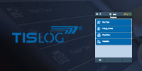


Map function in TISLOG office Infodesk
Visualize routes, stops and vehicles easily with the map function in TISLOG office Infodesk

September 18, 2018
The map view in TISLOG office Infodesk is a valuable tool that helps you compose and visualize different scenarios. With autozoom, different views, user-selectable map sections and configurable colors, orientation is a breeze.
The following information, among others, can be displayed on the map:
- ETA with target and actual lane
- Traffic information (e.g. traffic restrictions)
- Distance measurement information
- Vehicle positions, stop addresses and stopping points
- Order information
The information to be displayed in the map can be defined in the basic dialog of the TISLOG office Infodesk web portal.
The map window can be configured individually. For example, you can set which map type should be displayed (satellite, hybrid or normal) and whether traffic information should be available. User-specific map sections can be selected from a separate menu. It is also possible to display different information layers simultaneously. This layer view can be used for comparisons (actual-target), for example.

Fig.: Different map types in TISLOG office Infodesk (Normal, Satellite, Hybrid)
Zooming and moving the map section works very easily via PC mouse.
The "Autozoom function" ensures that the relevant area displayed in Infodesk remains centered when zooming.
The display of vehicle groups or lanes in greater detail, depending on the zoom level selected also ensures a good overview.
Information at your fingertips
Tooltips via mouseover provide additional information about specific points on the map.
This includes, for example, the exact position of a vehicle, including information on driving and rest times, or GPS information, such as speed and direction.
In the ETA view, the estimated arrival time and distance are displayed here.
User-friendly configuration
For easy differentiation, user-defined colors can be assigned to various elements in the map (e.g. vehicles). Tooltips are also configurable. With a click, different features can be shown on the map at the same time and layers can be frozen for comparison.
With the simple distance measurement a fast distance determination between two destinations is possible. For this purpose, any number of points can be set on the map with the mouse. Several measurements at the same time are also possible.
The map function in TISLOG office Infodesk offers many more useful features, which we will gladly explain to you in a personal consultation.
Are you interested in our products? Please contact us!
TISLOG Logistics & Mobility from TIS
TISLOG, the logistics software for your order management on the road and in the warehouse, integrates all logistical processes, from order processing over seamless tracking of goods to comprehensive fleet management. The modular product range offers components for the mobile terminals of your drivers and your head office. The system can be individually adapted to your IT infrastructure and your logistical requirements and also enables the integration of temporary charter contractors. The system can be connected to existing TMS via interfaces and data from TISLOG can be used.
Our sales team will gladly advise you!
Do you have any questions about this news or general questions about our products and services?
Our colleagues in the TIS sales gladly take care of your questions concerns.
Please give us a call:
+49 2871 2722-0
Or send us an e-mail

More News

Call us
+49 2871 2722 - 0
OFFICE HOURS
Mo-Fr 8 am - 5 pm
EVENTS
Meet TIS live
at trade shows
and other industry events